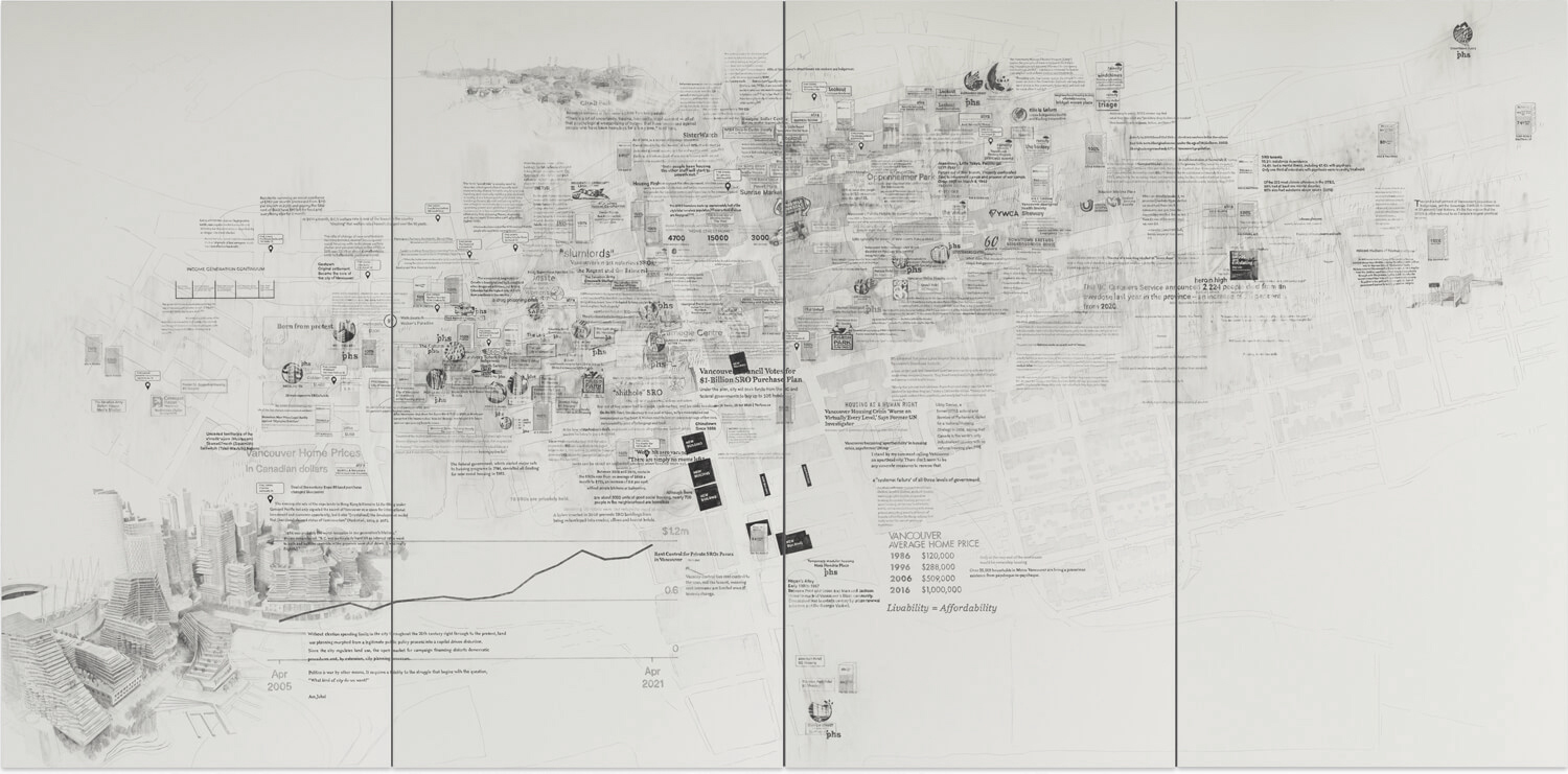
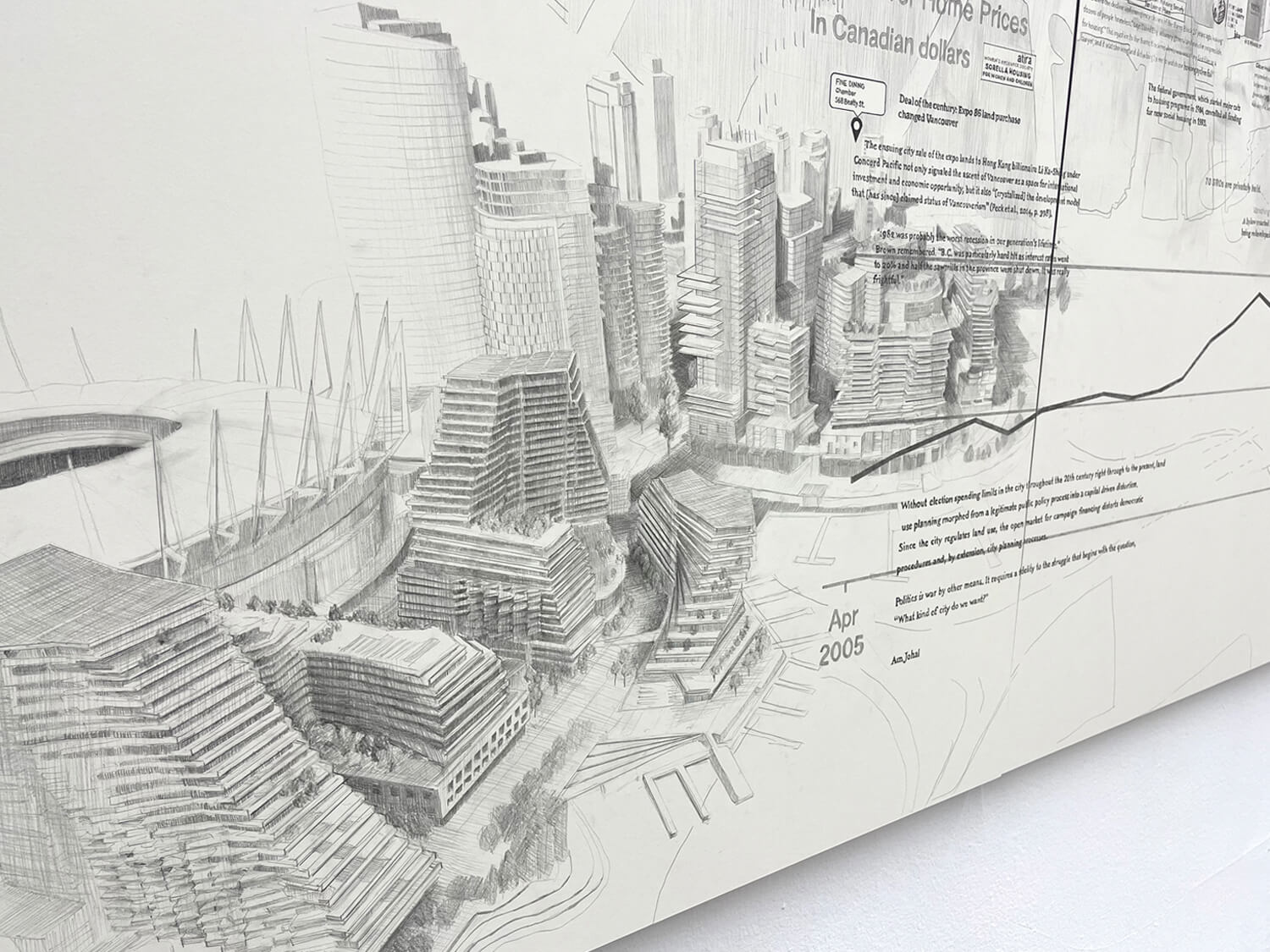
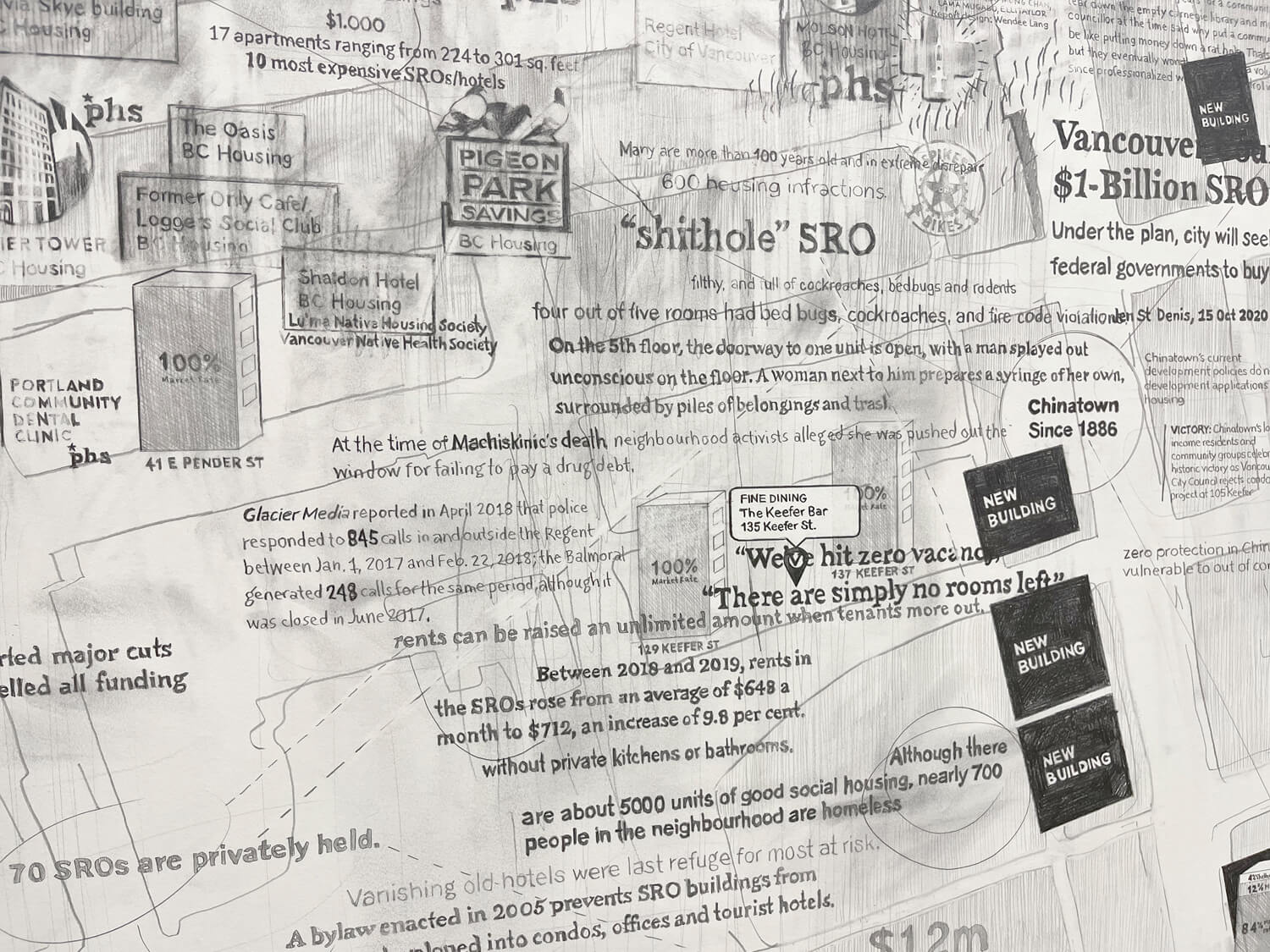
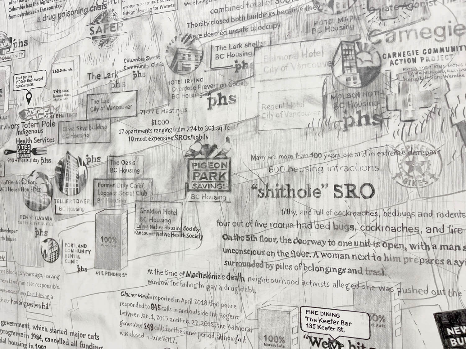
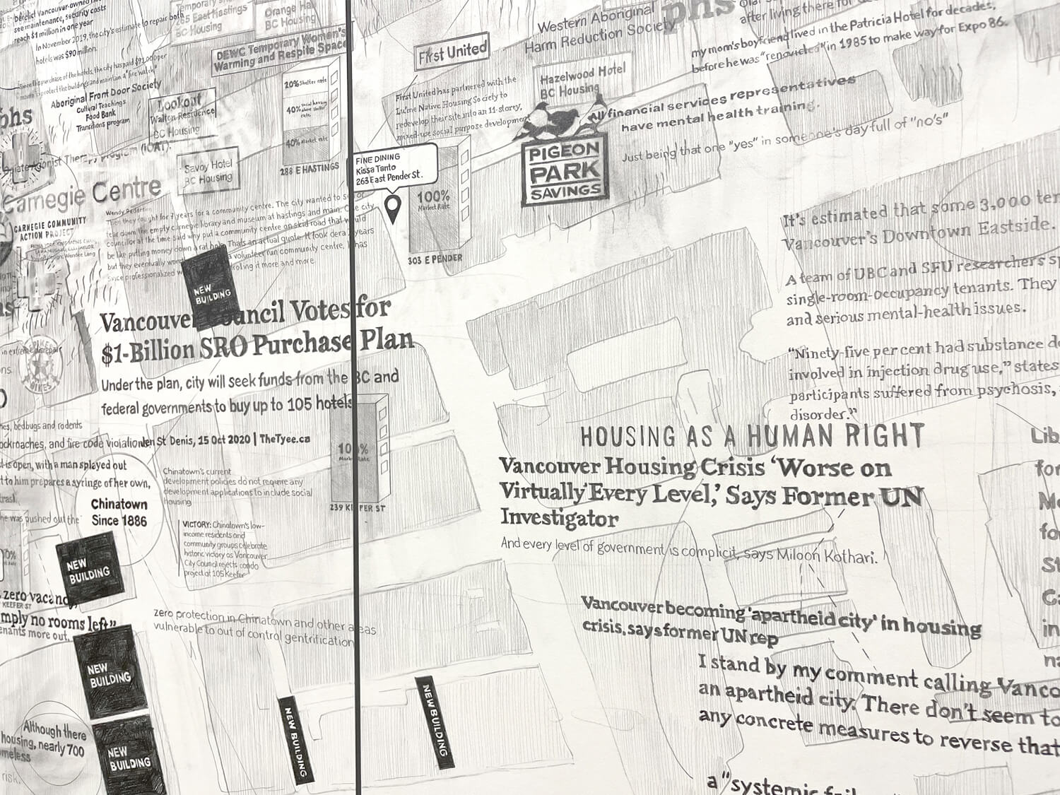
Vancouver DTES, 2022
This drawing depicts the geographical layout of Vancouver’s Downtown Eastside, with Hastings Street running diagonally from centre left to top right and Main Street cutting centre, top to bottom. Mapped onto this terrain are all of the Single Room Occupancy Hotels (SROs) and supportive housing in the area, as well as newly planned market-rate units. The drawing details rent prices and charts the rise of Canadian home prices.
It documents the impact of Expo ’86 and the 2010 Olympics, the sale of the Expo lands, and the new development at Northeast False Creek. It maps gentrification and the location of high-end restaurants moving into the area. It also records and reports facts and statistics on the deinstitutionalization of Vancouver’s mental health facilities, the drug poisoning crisis, homelessness, and the survival sex trade.
Contraste et indifférence (Part 1), Foundation Grantham, Quebec
Building Worlds, Kunsthalle Lingen (Images part 1)
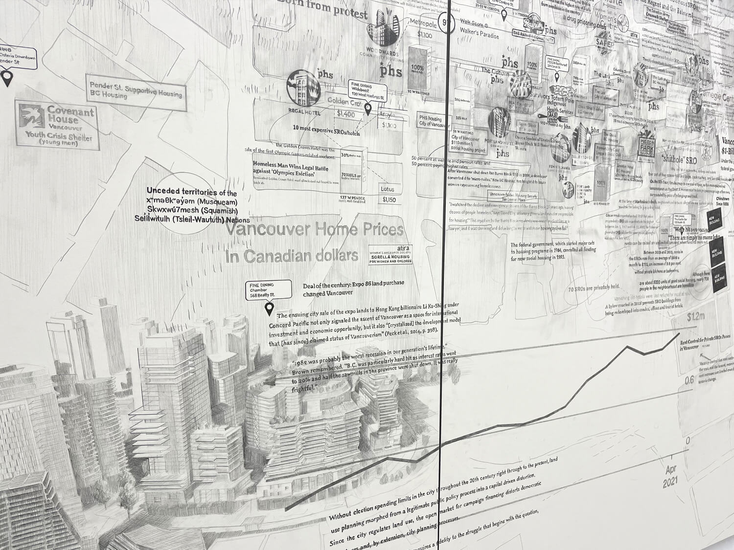
Detail
Detail
Detail
Detail
Detail